Dhanbad is a major district in Jharkhand, known as the “Coal Capital of India” due to its vast coal reserves and extensive mining operations. It is one of the most industrialized districts in the state and plays a crucial role in India’s coal production.
Geography
- Location: Eastern part of Jharkhand.
- Coordinates: latitude- 23.7998° N, longitude- 86.4305° E
- Total area covered: 2,040 square kilometers
- Altitude: 227 meters above sea level.
- Major Rivers: Damodar River and its tributaries (Barakar River).
- Neighbouring Districts: Giridih, Dumka, Paschim Bardhaman (West Bengal), Bokaro
- Topography: Dhanbad is part of the Chotanagpur Plateau and features a diverse landscape consisting of hills, plateaus, valleys, and coalfields.
- Climate: Dhanbad experiences a humid subtropical climate.
History & cultural significance
Dhanbad has a rich history, evolving from a tribal region into “India’s Coal Capital.” Originally part of Manbhum district under British rule, it was home to Santhal, Munda, and Oraon tribes. Coal mining began in the late 19th century, and with railway expansion in 1907, Dhanbad became a major mining hub. It became a separate district in 1956 under Bihar and later became part of Jharkhand in 2000. The nationalization of coal mines was done in 1971 boosted industrial growth.
Demographics (As per Census 2011)
- Total Population: 2,684,487
- Sex Ratio: 908 females per 1,000 males
- Literacy Rate: 74.52%
- Languages Spoken: Hindi, Khortha, Bengali, Santhali, Maghi, Urdu, Bhojapuri and Kurmali.
Administrative Divisions
Dhanbad district is divided into two subdivisions and ten blocks.
- Subdivisions:
- Dhanbad
- Baghmara
- Blocks:
- Baghmara
- Baliapur
- Dhanbad
- Gobindpur
- Jharia
- Nirsa
- Topchanchi
- Tundi
- East Tundi
- Egarkunr
Economy:
- Coal Mining (Main Industry):
- Houses 112 coal mines
- Annual production: 27.5 million tonnes.
- Major Coal Companies are Bharat Coking Coal Limited (BCCL) and Eastern Coalfields Limited (ECL).
- Industries:
- Coal Washeries and Power Plants.
- Steel & Iron Factories in Sindri & Kandra Industrial Area.
- Agriculture:
- Major Crops: Rice, maize, wheat, and pulses.
- Trade & Commerce:
- Wholesale markets for coal, iron, and steel products.
Education & Healthcare:
- Educational Institutions:
- Indian Institute of Technology (IIT) – Indian School of Mines (ISM), Dhanbad. One of India’s premier engineering institutions.
- Binod Bihari Mahto Koyalanchal University (BBMKU).
- Birsa Institute of Technology (BIT), Sindri.
- Other Notable Schools & Colleges: Delhi Public School (DPS), Kendriya Vidyalaya, Law & Management Colleges.
- Healthcare:
- Shaheed Nirmal Mahto Medical College & Hospital (SNMMCH).
- Central Hospital, Jagjivan Nagar – Run by Bharat Coking Coal Limited (BCCL) for coal miners and employees.
- ESIC Model Hospital.
- Patliputra Medical College & Hospital (PMCH) – Private wing – Offers advanced medical care.
- Asian Dwarkadas Jalan Super Specialty Hospital.
- Asarfi Hospital.
- Shree Jagannath Hospital & Research Centre.
Transport & Connectivity:
- Air: Nearest Airport: Deoghar Airport (Approx. 100 km).
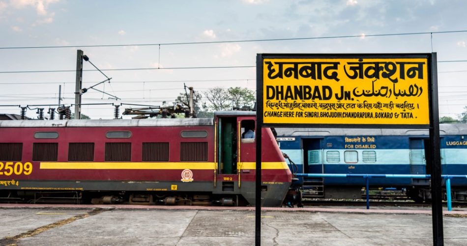
- Rail: Dhanbad Junction – A major railway station on the Grand Chord Line. Important trains like Rajdhani Express, Shatabdi Express, and other superfast trains connect Dhanbad.
- Road: Connected via National Highway (NH) 2 (Delhi-Kolkata Road). Bus Services available to major cities like Ranchi, Kolkata, Patna, and Jamshedpur.
Tourist Attractions:
- Religious & Cultural Places:
- Shakti Mandir – Famous Hindu temple dedicated to Goddess Durga.
- Natural & Recreational Sites:
- Maithon Dam – Scenic dam on the Barakar River, perfect for picnics and water sports.
- Topchanchi Lake – Beautiful lake surrounded by hills, a popular tourist spot.
- Bhatinda Falls – A picturesque waterfall ideal for nature lovers.
- Panchet Dam – Another important reservoir near Dhanbad.
Challenges & Development Plans:
- Challenges:
- Coal Mine Fires: Underground fires in Jharia cause environmental and health hazards.
- Pollution: Air and water pollution due to coal mining.
- Land Subsidence: Some areas are prone to land sinking due to underground mining.
- Development & Government Initiatives:
- Jharia Rehabilitation Project to relocate people from fire-prone areas.
- Industrial Expansion: Promoting industries beyond coal.
- Smart City Project: Developing Dhanbad into a modern city.